
Tim Mersoï Fm
Type Locality and Naming
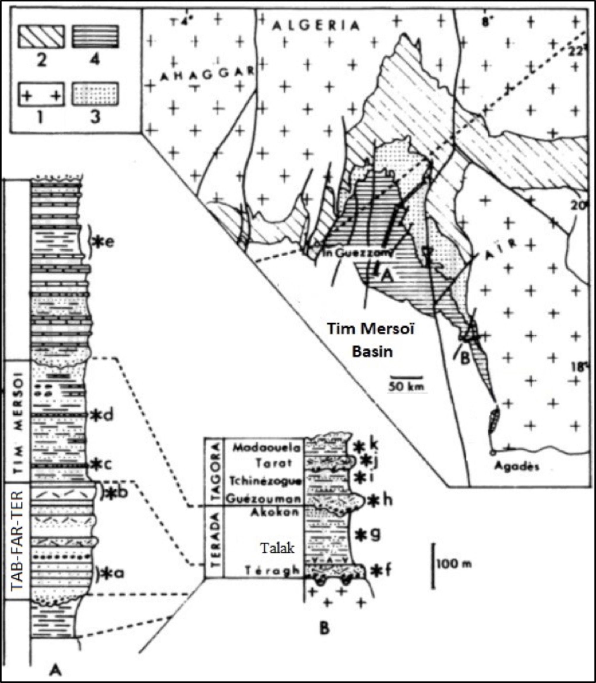
Type locality at "Reg du Tim Mersoï", about fifty km SE of In Guezzam (Niger) (Section A in Fig. 1). Group: Terada Gr
[Figure 1. Section A) Touaret - Tim Mersoï area. Section B) Talak area. 1) Precambrian. 2) Lower Paleozoic to Middle Devonian 3) Upper Devonian and Lower Carboniferous (Taberia Fm, Farrazekat Fm and Teragh Fm). 4) Lower Carboniferous (Tim Mersoï Fm & Talak Fm). *a to *k are the main fossiliferous horizons (Source: Modified after Martinez Diaz, 1983).]
References: Lessard, 1961 emend. Claret & Tempère, 1968; Valsardieu, 1971; Legrand-Blain, 1974; Fabre et al., 1983; Martinez Diaz, 1983.
Synonym: Tim Mersoi Fm, Tin Mersoï (misspelling). Equivalent(s): Talak Fm; Aoulingen Fm
Lithology and Thickness
Clayey silt, and some gypsum; it contains thin levels of lumachellic calcareous sandstone, more rarely sandstone, and, at its upper part, clay pebbles and ferruginous nodules. It is slightly eroded at its top. Thickness: 445 to 715 m. On page 51 of Valsardieu (1971), it is stated a thickness of 270 m in the area of Touaret.
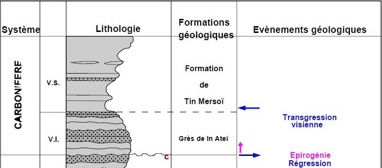
[Figure 2. Tim Mersoï Fm transgression-transition from the underlying sandstones of the In Ateï Fm (sandstone – now part of the Teragh Fm) interval within the Lower Carboniferous (Lower Visean) of Algeria (Source: Mammar, 2012).]
Relationships and Distribution
Lower contact
Underlain by the Teragh Fm (see Figure 2).
Upper contact
Overlain by the Guezouman Fm
Regional extent
GeoJSON
Fossils
Brachiopods (Histosyrinx valrini and Marginalia betainensis (Legrand-Blain, 1974) Spiriferids (Spirifer duplicostata, Spirifer striatus, Syringothyris cuspidata)). Fauna of Productids (Productus cora, Productus antiquatus, Productus semireticulatus) (Valsardieu, 1971).
Age
Depositional setting
Marine
Additional Information